Navigation, offline maps, and more on the free Roam app.
Get the AppYankee Hill Road
No elevation data available
Description
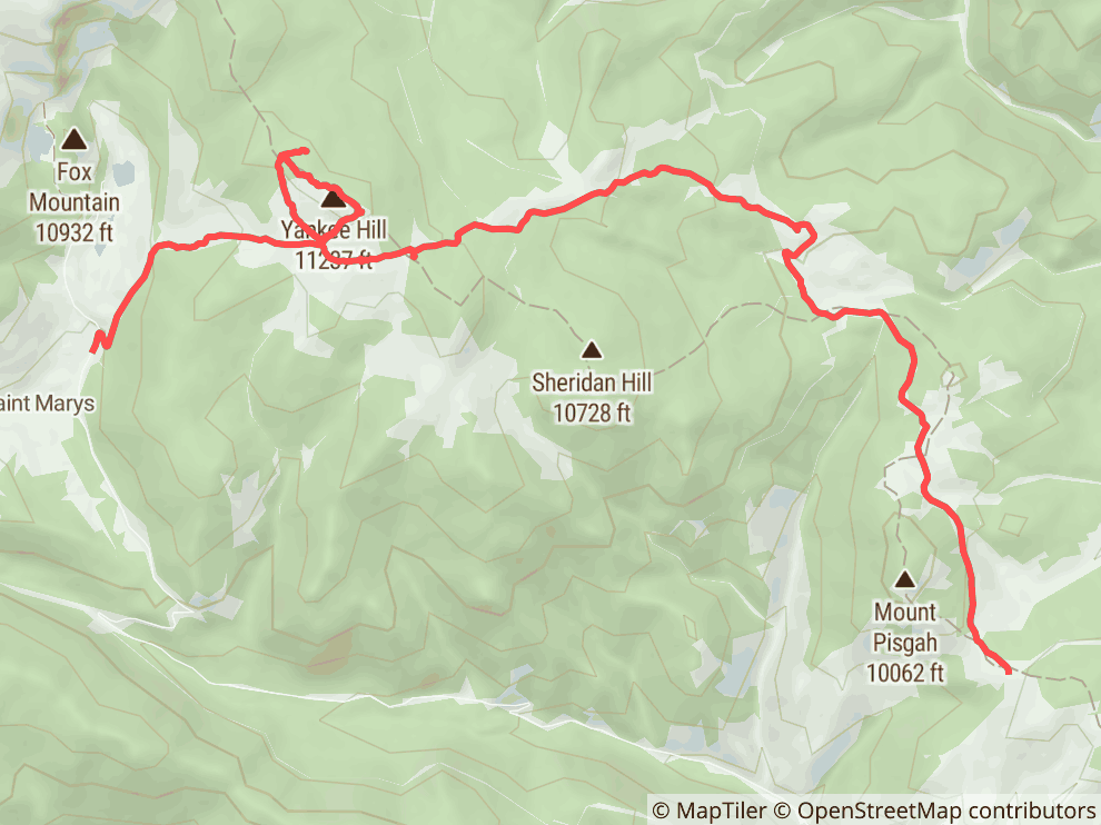
Yankee Hill Road offers a fun and adventurous off-road experience through a network of historic mining roads in the Arapaho National Forest, conveniently located near Denver and Idaho Springs. This area, often referred to simply as Yankee Hill, is a favorite among local off-roaders. You'll explore a rugged and mostly barren mountainside, with the actual Yankee Hill summit being a highlight, offering a moderate hill climb and rewarding you with incredible high-altitude views of prominent peaks like James Peak, Mt. Bancroft, and Mount Evans. The trail system can be a bit of a maze, so a GPS unit is highly recommended to navigate the various routes. Expect varied terrain including rocky sections, steep climbs, and potentially water crossings. The area is rich in mining history, with old mine tailings visible along the way. Some routes pass through ancient forests with trees over 500 years old. It's a great introductory trail for adventurous drivers looking for a bit of everything Colorado off-roading has to offer without committing to an entire day on the mountain.
Directions
Yankee Hill Road has multiple access points, making it a versatile area to explore. A GPS is highly recommended due to the confusing network of trails.
Western Access (near Idaho Springs/Fall River Road):
- From I-70, take Exit 238 (Fall River Road) just past Idaho Springs.
- Head north on CR 275/Fall River Road. After approximately 6.6 miles, turn right to stay on Fall River Road.
- Go another 0.5 miles and turn left to stay on Fall River Road.
- Continue for 1.4 miles and turn right onto Mine Road.
- Turn left to stay on Mine Road. Continue 0.4 miles and take a slight right turn onto Jeep Road.
- Follow Jeep Road for 0.5 miles to an intersection; turn right and continue uphill. This is a common start for Yankee Hill Road from the west.
Eastern Access (near Black Hawk/Central City):
- From Black Hawk, CO, head southwest on Gregory Street.
- Gregory Street turns slightly left and becomes Lawrence Street. Continue for 0.5 miles to Eureka Street.
- Continue 0.5 miles and turn right to stay on Eureka Street.
- Continue 0.3 miles to CR 3/Upper Apex Road.
- At 0.4 miles, turn left onto CR 1-N/King Flats Road.
- Go 1.6 miles to a bend in King Flats Road and continue straight onto Bald Mountain Road.
- Follow Bald Mountain Road for 1.9 miles to an intersection. Take the right fork to head north on CR25/Pisgah Lake Road. This road is part of the Yankee Hill network.
Other noted access points include Cumberland Gulch and near St. Mary's. Some areas, like near the Boodle Mine and historical cemeteries, prohibit vehicle unloading; the designated unloading area is often down Columbine Campground Forest Road.
Difficulty
The Yankee Hill trail system offers a range of challenges, generally considered easy to moderate with some potentially difficult sections. You'll encounter narrow and rocky paths, with some parts being quite steep. While there might not be major, single obstacles on all routes, expect chewed-up rocky sections, especially in the middle of some trails. Some routes include steep climbs, rock gardens, and occasional water crossings. The biggest challenge for many drivers is navigation due to the extensive and sometimes confusing network of old mining roads; a reliable GPS is strongly advised to avoid getting lost. Most of the network can be handled by a high-clearance 4WD SUV, but conditions can vary, and some sections have become rougher over time. Some users have found certain parts more intense than expected, particularly on motorcycles or less prepared vehicles.
Trail Uses
- Off-Road Vehicles
- 4x4 Vehicle
- All-Terrain Vehicle
- Motorcycle
- Snowmobile
Recent Adventures

Yankee Hill
EPIC VIEWS
The text and geometry of this object available under the Creative Commons Attribution-ShareAlike 4.0 license